Nahatlatch
Places to go, things to see and do. Go for a walk or hike, have lunch on the beach or just sit and enjoy the view.
Sit back and put your feet up. This could take a while. Just a few places to see in and about our valley, some you have heard of and others not.
Places like Kwoiek Creek and Tachewana Creek.
Most of these are day trips but not all…

Nahatlatch Lake/The Backend
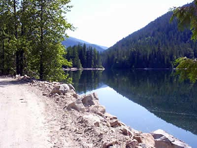
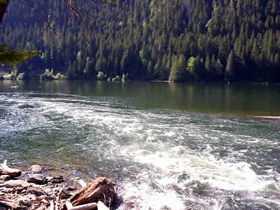
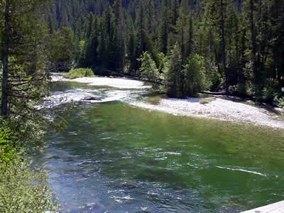
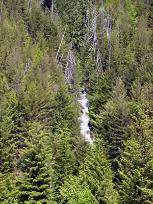
Gravel Beach at about 33.5 kms Nahatlatch Lake
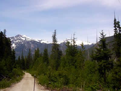
You are at 13.8 km on the Nahatlatch River Road if you like a short walk or drive, just past 14 kms at the top of the hill is a great view of what Rafters call the Meat Grinder. Careful it is a long way down. Continuing down the road you will cross over a bridge keeping to the left staying on the Nahatlatch River Road.
Passing Log Creek Campsite and Kookipe Creek Bridge you will come to 15kms. Next is the Park!
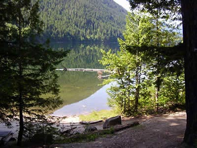
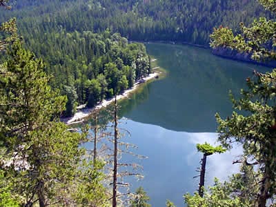
Nahatlatch Provincial Park and one of the 3 lakes that we have in our valley. Frances Lake is about 1 km long and the road follows it along.
At 16.5 kms the Nahatlatch flows into the lake and it is a good spot to fish. Please be careful in doing this, the road is narrow and the bank is steep. The next lake starts at 17.5 kms, there is a 1km stretch of river between the 2 lakes.
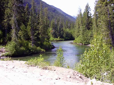
This is Hannah Lake. Great lake for canoeing, just a little hard to get the canoe or boat in the lake but at 18.5 kms is the Old Rangers Station and it is possible to launch the boat there.
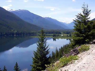
Just past the 21 km mark is Nahatlatch Lake, a great spot to launch a boat or canoe. There is a washout in the road, so access is best suited for 4x4 vehicles, Side by Sides, bikes, quads, or a great opportunity for a hike.
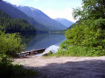
The road follows along the lake for quiet some time.
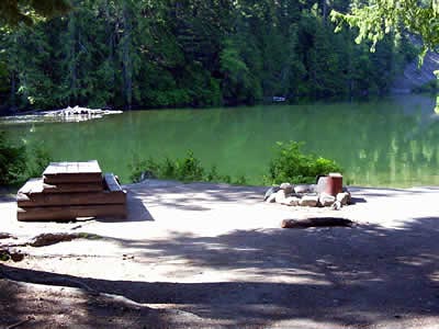
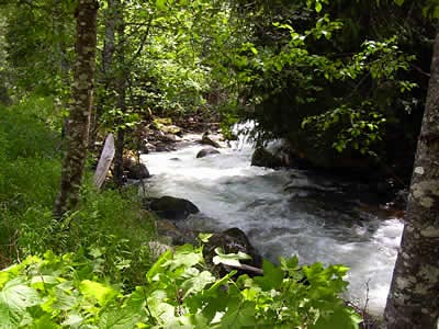
Salmon Beach is at 22.5 kms (another boat launch) and at 25 kms is Squakum Creek. Where this creek flows into Nahatlatch Lake is a great fishing spot. A little tricky to get there. You can hike down the creek, park at the bottom of the hill before Squakum Creek and walk the lake or go to Squakum Campsite (turn left) and also walk the lake.
From this campsite following the main road you will drive up a steep hill at the top pull over and park. Go out to the big rock that over looks Nahatlatch Lake. Check out the View from the big rock!!!!!!!
At about 26.5 kms is another spot to stop and take in the view. Be careful the road is narrow.
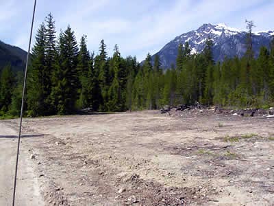
Driving along at 33.5 kms there is a yellow gate on the left you can pull over and park in front of it.
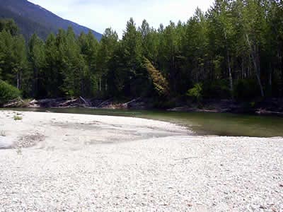
The hike down to the gravel beach should only take about 10 to 15 minutes. There is a Y in the road, stay to the left. This is a great place to see Salmon spawning in September or just walk on the beach and have lunch. Please no firers on the beach.
During spawning time you will be able to see Bears and Bald Eagles, lots of yellow jackets and it smells a bit. This is a sight to see. Be careful.
Heading on down the road to 34.5 km is Tachewana Creek.
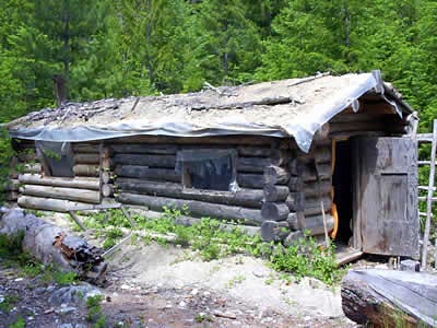
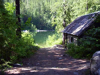
Just before you cross over the bridge there is a trail to the right. Its only a 5 minute walk and you will see a Trappers cabin (1980).
Carrying on, at about 43kms there is a trail to your left that takes you down to Tachewana Creek. This used to be the old road. Nice spot to take a break. If you hike to where in enters the Nahatlatch River, its said that its good fishing. Good Luck.
On the road again, take in the view while driving. The road is fairly flat and wide.
Just about 40 kms there is a large clearing to your right.
This is the start of Mehatl Falls Trail (Mehatl Provincial Park). It is not posted so you have to look for the road to start.
The hike will take you a total of 2 hours. Of course you must take in the sites so this is a good day trip, bring lunch. It will take you half and hour to walk into Bear Creek. From there it will take you another half hour to hike up to the falls. It is well worth the hike. The view is awesome.
Just up ahead you will see a bridge that crosses over the Nahatlatch River. This is a good place to put in a canoe for a trip down the river. Either side of the bridge is a good boat launch. You should be experienced in canoeing.
Also a nice spot just to take in the view and relax a little.
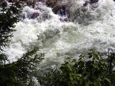
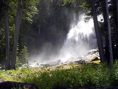
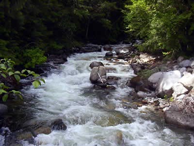
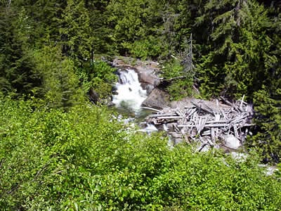
Grizzle Falls
Crossing over the bridge and take the first road to the left. Be careful not to miss it, if you do you will travel a km or 2 there will be a gate that is open.
Turning back if you missed the turn off, this time turn right on the next road you see. You are on your way to see Grizzle Falls, just 2 kms down the road. This is a must see spot. Awesome! Spectacular!

I will let the pictures say it all!

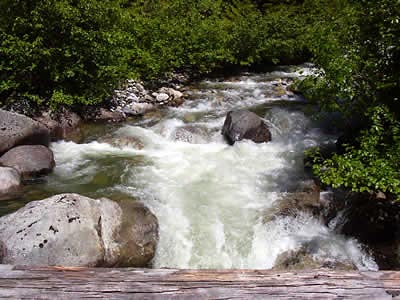
Is this pretty or what? The falls change all the time, depends on what time of year you visit. If you stand on the bridge you are sure to get wet.

There is nothing like this in the Valley that you can drive to. Stop and have lunch on the down side of the bridge. A very different river than the top.
Nice spot on the right side to have lunch or just stop for a spell and take it all in. Even on your way back you will get some good views.
Time to go back to the cabins. Its been quite a day!
From the cabins you travel up river, at 23 kms you can look down at the Nahatlatch River. Be careful it’s a long way down. Going a bit further down the road you will come to a bridge, cross over and take the road to your right.
You just crossed over Log Creek.
The lower part of the creek is good for fishing. When going up the valley the road gets steeper and may or may not have water bars on the road.
The creek that flows in Log Creek.
You will notice that this is a logging valley and you will be able to see new forests growing. They have been logging in this valley since the early 50’s. Some places you can’t even tell that they have logged, while others are just done in the last 5 years.
You can only drive up Log Creek till about 6kms, then you will see a Y in the road. To the right is Hanging Valley and straight through is Log Creek. Lots of roads to travel or hike but not with a truck or car. Good for ATV’s or bikes. Enjoy the trip.